


The United Nations General Assembly has overwhelmingly backed an African-led campaign to encourage the use of world maps that more accurately represent the size of continents.
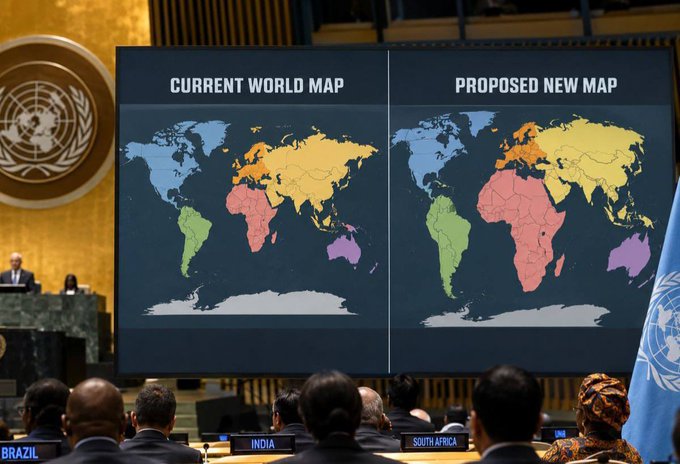
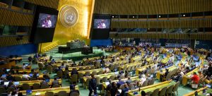
Member States voted 164 to one on Friday to endorse a resolution promoting equal-area map projections, including the Equal Earth projection, which gives a more accurate picture of the relative size of landmasses.
The United States was the only country to vote against the resolution, describing the initiative as part of a broader “radical ideological project”. Six countries — Estonia, Georgia, Lithuania, Moldova, Serbia and Ukraine — abstained.
The resolution does not ban the widely used Mercator projection or require countries to adopt a particular replacement. Instead, it encourages governments, schools, international organisations and technology companies to use equal-area maps where relative size matters and to teach the limitations of representing a spherical Earth on a flat surface.
Why Africa looks smaller
The campaign, led by Togo on behalf of the African group and backed by the African Union, targets a distortion that has shaped how generations have visualised the world.
Created by Flemish cartographer Gerardus Mercator in 1569, the Mercator projection was designed primarily for navigation. It preserves direction but increasingly enlarges landmasses the farther they are from the Equator.
The result is a familiar but misleading image of the world.
Greenland can appear comparable in size to Africa, yet Africa is about 14 times larger. Northern Europe and North America are similarly exaggerated relative to regions closer to the Equator.
Togo’s Foreign Minister Robert Dussey said maps influence more than navigation.
“Maps shape our understanding of the world,” Dussey said. “They guide education, nourish the imagination, and influence collective perceptions.”
The resolution argues that such distortions have contributed to the “symbolic minimisation” of Africa and calls for greater awareness of how maps shape perceptions.
‘A fair map’
The African-led campaign does not seek to erase Mercator from history.
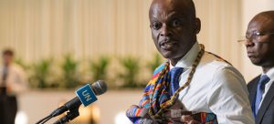
Dussey acknowledged its usefulness for navigation while arguing that other projections are better suited to showing the true relative size of continents.
“A fair map does not change the geography of the world; it changes how we see the world,” he said.
The Equal Earth projection, developed in 2018, is among the alternatives promoted by the resolution because it preserves relative area more accurately.
The issue has also gained support beyond Africa. France announced shortly before the vote that it plans to move away from Mercator for its world maps and adopt an equal-area alternative.
US objects, EU backs resolution
Washington opposed the resolution, arguing that its language around “cognitive justice” and reparations went beyond cartography.
The US representative said the initiative was part of a “much larger and more radical ideological project” and warned that such measures risk undermining the credibility of the United Nations.
Ukraine, which abstained, raised concerns about how Equal Earth maps could depict territories occupied by Russia. The European Union supported the resolution but stressed that the measure concerns the relative size of landmasses and has no bearing on sovereignty, territorial status or internationally recognised borders.
The resolution is non-binding, meaning Mercator remains available for use and no government is required to change its maps.
The vote nevertheless represents a significant diplomatic victory for the African-led campaign.